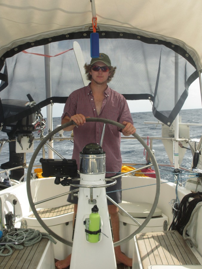
A brisk sail in twenty knots of wind and six foot seas brought us to the island of Nuku Hiva, administrative center for the Marquesas and the most leeward of these ancient volcanic islands. We departed Tahuata island at 7 a.m. on May 15, with reefed main and full jib on a broad reach for this 84 nautical mile jaunt. With the occasional breaking wave on the stern quarter, veering Anthea’s bow into the wind, we needed more than the ¼ turn of wheel afforded by the windvane to bring her bow back down and on course, so Mark, Anson and I took hour stints at the wheel, surging forward at seven to eight knots. Even so, we arrived at Taihoae Bay after dark.
The Bay has an easy approach with no shallows or hazards, and our electronic chart and AIS agreed perfectly once again, showing boats in the middle of the anchorage exactly where we would expect them to be. This alignment gave us the confidence to proceed cautiously forward, spot light ready, all hands on deck. Once in the lee of the land we doused the sails and motored ever so slowly forward. Slipping into a slot between well-lit boats and ghostly hulls illuminated only by our lights, we happily anchored, stowed the chaos from the mini passage and slipped into berths.
Our days at Taihoae Bay slipped by. We savored the abundance of town, devouring baguettes, pastries, fresh fruits, vegetables and fish; we met up with Bella Serena’s crew, folks we met in La Paz, and helped them negotiate life without a dinghy (sadly lost at sea) and assisted with an engine repair; and we hiked to sites both old and new – ancient ceremonial grounds reclaimed for contemporary Marquesan arts and cultural festivals. The promise of internet ashore was also enticing, but ultimately frustrating. Several late night dinghy jaunts to the café by the wharf in hopes of higher speeds enabled a few more books to be downloaded and the most recent batch of photos uploaded, but the internet only trickled and never reached the elusive 512 kb (not Mb!) per second stream we were hoping for. The next batch of photos will wait for Tahiti where internet speeds should align more with our needs.
But town life is only good for so long when there are quiet anchorages calling, so on May 20th we set sail for dramatic Taioa Bay (aka Daniel’s Bay), just 5 nm from Taiohae. A 1600 foot cliff, rising steeply from the sea, frames the western side of the bay. This wall of volcanic rock cloaked in lush green growth undulates like an accordion or the pleats of a sari, as wind and sea have eroded canyons – some narrow, a few mysteriously deep- along the length of the massif. The showers of spray against its walls, as ocean waves crash to create the fireworks of the sea, appear only as decorative lace, so dwarfed are they by the sheer wall of volcanic rock. Turning sharply southward into a small lobe of the bay, we anchored in protected waters, with land visible on all sides.
The water here is not very clear, but filled with marine life. Each morning we witness the thrashing fury of a shark catching her breakfast, schools of juvenile fish (tuna perhaps?) swimming around our boat, and the occasional manta ray gliding soundlessly by, wing tips gracefully piercing the surface of the water. With sharky, murky water, the land is the main attraction for us. On May 21st, with clear skies on the horizon, we dinghied ashore for a hike to Vaipo waterfall (aka Ahuii waterfall), reported by one guide book to be 1150 feet high and the third highest in the world (really??).
We set out on the journey with fond memories of a hike on Fatu Hiva to a two hundred foot waterfall. That hike began as a stroll through the village, an amble along a dirt road, and then a short hike on muddy paths, across shallow streams, and over small boulders to reach a magical cascade of water plunging into a pool. We swam to the base of the fall, forged the current to find narrow spots between the sheer rock face and the torrent of pounding water to experience the power of the falls. Small rainbows danced across the cliff face where sun refracted in the mist and spray. Our hike back was just as wet as the swim, as one squall after another dumped its rain upon us and the increasingly muddy trail. For this Fatu Hiva waterfall excursion, we hiked with fellow cruisers, getting to know Diego (life-long sailor from Italy) and Marina (a journalist from Brazil), as well as Jack (from Houston) and Monique (with roots in Peru and Germany), while slipping in the mud and winding our way back to the harbor.
With visions of a waterfall six times higher than the one on Fatu Hiva, we eagerly set out on our second waterfall hike from the beach landing at the small settlement of Hakaui (at the head of Taioa Bay, Nuku Hiva). After a hearty welcome from Teiki, who lives with his wife Kua at the first home and garden along the path, we journeyed along a beautifully tended path, bordered by a meticulously maintained hedge on both sides. The valley is narrow, framed by the sheer cliff on the west side and a river flowing down to the beach on the east. The homes and gardens of several extended families extend northward up the valley, and we journeyed through contiguous gardens of bananas, guava, starfruit, coconuts, breadfruit, limes and oranges, scattered through closely cropped grass lawns dotted with hibiscus, a lily like plant used for regalia for dances, and a variety of tropical plants reminiscent of overgrown California houseplants. A few chickens and pigs free ranged, while horses were tethered. The families in this valley created an association, and since the beginning of this year started charging a fee for a month pass through their land. (More later on the many strategies of interweaving subsistence and income generation in the context of tourism.) Mark made the trip back to the boat for the cash, while Anson, Devon and I continued on the 2.5 hour hike to the falls.
Soon we left the carefully cultivated land and began our hike through ancient gardens and home sites. The radical depopulation of these islands – due to the violence of colonialism, the ravages of disease, and the intracommunity violence that surged with the divide and conquer strategies of colonial rule, alongside the social dislocation from the maelstrom of whalers, beachcombers, sandalwood traders, and missionary condemnation of worldview and lifeways – was evident throughout the hike. While it would be easy to imagine we were walking through uncultivated jungle, a careful glance through the dense growth revealed stone walls and platforms overgrown with shrubs and vines. We were walking through house foundations, alongside ceremonial plazas and sacred sites, and the isolated homesteads of prophets. Ancient mango trees towered over stonework and coconut groves proliferated.
The path to the falls was well maintained by the community and easy to follow as we criss-crossed the small river, wading thigh high or leaping from boulder to boulder. Mark caught up to us after the first river crossing, and we proceeded up the narrow valley. Looking across the river and above the near ridge, we saw a powerful torrent of water cascading down sheer cliff, with the majority of the fall disappearing behind a canyon. The trail became less well-traveled after passing the warning sign of falling rocks, and it soon became apparent why. The box canyon with towering walls leading to the falls was a danger site. With no rain for several days, the risk was mitigated, but we were still cognizant that falling rocks from such perilous heights, no matter how small, could be lethal. We walked purposefully forward, eager to reach the falls and pass through the danger, only to see the tail end of the cascade plunging into a chocolate brown, murky pool. Had the water been clear, the fact that the main height of the fall was invisible from the base would not have seemed so disappointing. We would have frolicked in the water, explored the current and the force of the cascade, looked for rainbows and smiled at each other with delight. Instead we turned quickly around and walked to an indentation in the canyon wall. There we sat and ate pomplamous, sitting on three logs carefully placed under a protective overhang. We hiked back, appreciating the beauty of the long abandoned homesteads overgrown with fruit and flower, and the emergence into manicured gardens with life abounding.
While the distant view of the falls was dramatic, the waterfall itself was not the gem of this outing. Rather it was the hike through time: gardens and stones ancient and abandoned, merging into the manicured present with life abounding and survivance (resistance through survival) so evident.
Uncategorized
Photos from the crossing

Crossing in comfort
Anson relieving “Windy”

Just another day

We Have Crossed!

Dad in his getup for the crossing

Taking a Sight

Finding a cooler place to read

Landfall!!

Walking Over the Ridges
A week ago (May 11) Kim, Mark and I went for a walk to the historic town of Vaitahou. As we had to dinghy to the next inlet over, we had a ten-minute ride to shore. The landing spot was behind a small breakwater where there was a ramp and a place to tie up. As we neared the ramp a man standing on the edge shouted, “Attention, ca glisse!” (Be careful, it’s slippery). We nodded and Mark said “Merci,” but when we stepped out of the dinghy we realized how true the words were. Mark almost fell on his face, and Kim had hold onto the edge, completely abandoning Mark and me, who had to push up the dinghy. After a minute or two of struggling we wheeled the dinghy next to the outrigger canoes and put our shoes on.
Mark, Kim, and I started following a road that gave us a view of the ocean. Seeing a chance for school, Kim immediately started a French lesson. Ten minutes of gorgeous scenery later, we came to a dead end. After turning around and reaching the village where we had started, it promptly started to rain. Kim and I followed Mark to a building with a covered, concrete porch. We took shelter there and got directions to Vaitahou. We left and started walking up a different, steeper road. We were passing lots of tall trees, most of them coconut, but some were banana and banyan. It was raining for most of the trip, so we were utterly soaked, and the streams we crossed were raging. Wild Marquesan horses grazed on the side of the road. Around half way through the walk, we came upon a group of cows and bulls. The road at this point was only 10 feet wide, and one of the bulls was giving us the evil eye. Timidly, we skirted around it and even walked in water to get farther away. Thankfully all the bull did was turn its head around.
After three hours of stressful ascending and descending, we walked into Vaitahou, our legs almost collapsing. It was starting to rain yet again, so we hurried under the roof of a beautiful, open church. It had a 20-foot-wide porch surrounding the front half of the building. At each of the six corners there were arches made out of small stones supporting the ceiling. Around the pews there was a four-foot-tall wall, leaving the top twenty feet open. On the doors there were beautiful carvings, both Christian and Marquesan motifs. As soon as the rain stopped, we left and went to see the memorial of Iotete, a leader of the Marquesan people who we had read about in the church. Near the memorial there was a woman waiting for the rain to pass. We struck up a conversation and asked her about getting a ride back to the other village. We were just leaving when she was able to flag down a car for us. We sprinted to get ice-cream which we then offered to the driver.
On the drive back we talked a little and expressed our interest in how copra, dried coconut meat, was produced. Our driver actually stopped the car repeatedly to get coconuts so he could demonstrate the process. When we arrived at his house, right next to the ramp, he got an ax and two metal scrapers. He split the coconut open with his ax and the used the scraper to peel the meat out. He then gave it to us to eat. The meet tasted bland and oily. It had a crunchy texture, sort of like an apple. We also bought a bottle of handmade, all natural bug repellent, pressed from the nut of a local tree. We left and went back to our dinghy where some young children helped us put it in the water, slipping and sliding all the way. Devon.
Laundry Day
We made one serious mistake on our passage: we didn’t do laundry for three weeks straight. We never sat wallowing on a windless day, aka laundry day, so we arrived in Atuona, Hiva Oa with a mound of unwashed clothes, sheets, towels, dish towels, etc. There’s no laundry mat in Atuona, and the cost of having laundry washed was prohibitive for the kilos we had accumulated. We each chose our most precious clothing and gave it to Sandra (the agent who assists arriving yachts)to wash and dry in her machines and then waited for that perfect laundry day. With the squally weather, that day never arrived. Over the next ten days we grabbed bits and pieces of clothes and did emergency laundry to keep ourselves minimally presentable, but the mounds of unwashed cloth continued to grow. By the time we left Fatu Hiva, known as the rainiest island in the Marquesas, we decided that sun or no sun, the laundry had to get done.
On Tahuata Island, after the glorious dolphin and manta ray sighting, we gathered up the bags of laundry, our bucket and detergent and headed to shore in the dinghy. The waves were crashing gently on the boulder strewn shore line, and we motored back and forth looking for a potential jumping spot from dinghy to rock that would place us closest to a stream emptying into the ocean. Our first attempt failed, as Mark landed gracefully on a volcanic ledge only to find himself with no path to the stream and surrounded by scuttling crabs. Take two involved a scramble on a boulder and quick tosses of laundry and bucket, each timed by Devon as he masterfully shifted from forward to reverse to keep the dinghy off the rocks. Safely ashore, Mark and I had to transport laundry and supplies across large boulders covered with small, red ants and the occasional scuttling crab. Being a bit squeamish I had to convince myself that this was still a good idea and focus on my footing so that laundry day didn’t turn into medical emergency day. It was a fifteen minute scramble to the stream, with sure-footed Mark making several trips to carry the load of clothing while I slowly moved myself and then the bucket of supplies. It all seemed like a very bad idea until we arrived at the waterfall. With beautiful coconut trees and hibiscus shading the small pools, and a twenty foot fall into smaller cascades, we found ourselves in a bit of paradise. Even the ant population diminished to an acceptable level. We set up our operation: a small pool served as the pre-wash soak, the bucket for washing central, a small cascade became the rinse station, and a boulder with minimal ant population held the wrung out laundry. It was hard work, but the glorious setting and the merciful shade took the edge off the task. Midway through the mound of laundry we took a break and ate a delicious pamplemousse (large, sweetish grapefruit which grows abundantly on the islands), rinsing the juice from our arms and faces in the rush of the waterfall.
Several hours after landing, we had two large bags of clean, wrung out laundry and a scramble ahead of us. Fortunately, Mark’s toss of the bags into the dinghy was spot on, and Anson’s maneuvering of the dinghy timed perfectly. Mark and I swam out beyond the crash zone, lumbered aboard the dinghy and then arrived at Anthea in brilliant sun light. All hands on deck, we strung clothes lines to augment the lifelines and still found ourselves short of space to dry the vat of laundry. Dancing to the Beatles from our portable speaker, we covered the deck in socks and t-shirts until every item was in the sun. Then the race was on: how much laundry could we dry before the next squall arrived? We spent hours turning clothing, adjusting sheets and towels, so that we could dry as many items as possible. The outcome was quite good: all the sheets dried, and the thinner pieces of clothing as well. We cut the load in half.
Drying the second half of the items was much more laborious and took two days of the game of “laundry out, laundry in.” With each squall we strung the damp clothes down below, as mildew always seems to be seeking piles of dampness. When the sun shone again, out went the socks, t-shirts,and shorts that stubbornly refused to dry. Once again we were reminded of monsoon in Kangra, remembering clothing that hung onto moisture despite days of hanging on lines. Kim
May 13: Spinning Dolphins
“Kim! (Pause) Kim!” “Ummh.” “Stick your head out of the forward hatch and look starboard,” Mark urged. I pulled myself out of a dream about teaching and rose up from bed. My bleary eyes worked hard to focus in the direction of the resounding splash 150 feet off our starboard bow. And then the scene came into focus: a dolphin leaping and spinning in the air, full body above the sea, landing flat on its side, sending a shower of spray into the air and a powerful crash echoing off the steep mountain wall framing the anchorage. The rest of the pod of dolphins was nearby, swimming slowly through the water, dorsal fins slicing precisely through the surface of the sea, with only their breath making sound. For an hour we watched this pod of dolphins fish around our anchorage on the island of Tahuata. Occasionally one of the dolphins would leap and spin and make a resounding splash, always on the fringes of the pod. At times a baby would leap alongside an adult, its tiny body struggling to twirl more than a full circle before crashing on the sea. We drank our coffee and wandered around the boat for the best viewing point. As I finished my coffee, a rainbow shone brilliantly over the ocean, the magical consolation prize of the frequent squalls.
Dolphins leaping under rainbow sky seemed gift enough for the morning, but we were graced with one more delight: a current line paralleled our boat, only ten feet away from our port side, and along the line swam fish and a gorgeous manta ray. The ray swam slowly along the line of bubbles, its fins delicately piercing the surface of the water, and its mouth gaping open to filter breakfast from the sea. The gentle morning sun illuminated its dark wings against the agate blue water, and the white of its mouth glistened as it passed by. We were treated to several passes by our boat, distracted only by more dolphins feeding and spinning.
The anchorage, we found out later, is called Dolphin Bay by the residents of the nearest village, a cove away. Strong currents run alongside the island of Tahuata, and the shape of Hanatefau Bay (our anchorage), channels the current and infuses it with nutrients and the rich marine life which pursues it. We were treated to this sight on May 11th, the morning after a delightful beam reach from Fatu Hiva.
Kim
